← Home · Underground Excavations

Geotechnical Excavation Monitoring: Instrumentation and Real-Time Control in Mississauga

Together, we solve the challenges of tomorrow.

LEARN MORE →

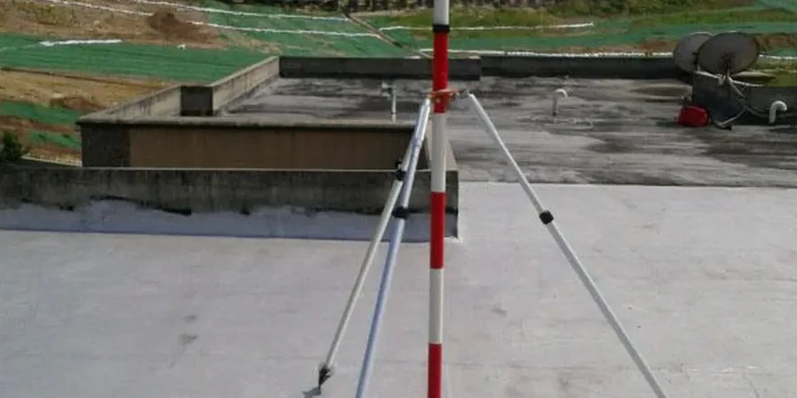
A total station and a row of vibrating wire piezometers are usually the first things we set up on a Mississauga excavation site. The Halton Till here is a dense silty clay matrix with cobbles and boulders left by the Lake Ontario ice lobe; it stands up well during shoring installation, but it can mask groundwater lenses that cause sudden instability. We monitor lateral displacement with inclinometer casings grouted behind the soldier piles, and we track settlement on adjacent structures using optical prisms mounted on the neighboring brick facades common in Streetsville. Because Mississauga’s building boom near Square One and along Hurontario pushes excavations right up against existing utilities, we pair our test pits program with continuous monitoring to confirm that the stratigraphy matches the borehole logs before the first lift is removed. For deeper cuts in the shale bedrock of the Credit River valley, we add crack meters on the rock face and read them daily against the baseline established during pre-construction surveys.

In Mississauga's Halton Till, the real risk isn't immediate collapse—it's the slow, silent movement undetected for days that compromises a shoring system.

How we work

The difference between an excavation near Port Credit and one up in Meadowvale comes down to groundwater behavior. Along the lake, the upper sand and gravel stringers within the Halton Till are often hydraulically connected to Lake Ontario, so water levels rise and fall with seiche effects; our standpipe piezometers pick up these fluctuations and we adjust the dewatering pump cycle accordingly. Inland, in the newer development blocks north of Highway 401, the till is thicker and the groundwater is perched in discontinuous silt lenses—you can hit a dry cut for two weeks and then intercept a lens that saturates the bench overnight. We experienced this on a 9-meter excavation for a data center foundation where we had to switch from sump pumping to wellpoint arrays mid-project. For sites where the shoring design calls for tieback anchors in the stiff clay, we correlate the anchor load cells with the inclinometer deflection curves to detect creep before it becomes visible at the surface, using the same instrumentation chain we apply in slope stability monitoring along the Culham Trail.
Geotechnical Excavation Monitoring: Instrumentation and Real-Time Control in Mississauga
Technical reference image — Mississauga

Site-specific factors

Mississauga sits in a snowbelt corridor where a late-March thaw after a heavy winter can saturate the upper two meters of soil within 48 hours. That rapid infiltration changes the effective stress behind shoring walls faster than most monitoring schedules can catch—unless you have automated readout units polling every 15 minutes. We have seen soldier pile walls near Cooksville move 12 mm in a single rain-on-snow event, well within the design envelope but alarming to the untrained eye. The bigger challenge is temperature drift in analog instruments: a vibrating wire piezometer installed in summer reads differently at minus 15 degrees Celsius, and if you don't apply the manufacturer's thermal correction factor and cross-check with an open standpipe, you can misdiagnose a groundwater rise. Settlement monuments on frozen ground also give false stability readings until the thaw reveals the actual consolidation that happened underneath. Our protocol in Mississauga runs from November to April with heated enclosures on all dataloggers and a weekly manual survey backup regardless of the automated data stream.

Need a geotechnical assessment?

Reply within 24h.

Email: info@geotechnicalengineering.co

Technical data

ParameterTypical value
Inclinometer casing depthUp to 30 m below excavation base
Piezometer typeVibrating wire and open standpipe
Settlement point accuracy±0.5 mm (optical level loop)
Load cell capacityUp to 1,200 kN for tieback anchors
Crack meter range50 mm with 0.01 mm resolution
Automated readout frequency1 to 60 minutes (adjustable)
Manual survey backup cycleWeekly during active excavation

Associated technical services

01

Shoring Wall Deflection Monitoring

Inclinometer probes in grooved casing grouted behind soldier pile and lagging walls, with data reduced to cumulative deflection plots compared against the design deflection envelope. We flag any rate change exceeding 3 mm per week for immediate review.

02

Groundwater and Pore Pressure Control

Network of vibrating wire piezometers installed at multiple depths within the Halton Till and underlying bedrock, connected to solar-powered dataloggers with cloud-based alarms. We correlate pore pressure changes with excavation stage and precipitation events recorded at the nearby Pearson Airport weather station.

03

Adjacent Structure Settlement Surveys

Precision optical leveling loops through settlement monuments mounted on neighboring foundations, sidewalks, and utility chambers. Baseline readings are established before any excavation begins, and the loop is closed on a deep benchmark outside the zone of influence.

Regulatory framework

NBCC 2020 Part 4 – Structural Design, CSA A23.3:19 – Design of Concrete Structures, ASTM D6230 – Standard Practice for Monitoring Earth or Structural Movement Using Inclinometers

Frequently asked questions

What is the typical cost range for geotechnical excavation monitoring in Mississauga?

For a standard excavation monitoring program in Mississauga—including inclinometer casings, piezometers, settlement points, and weekly manual surveys over a 3-month period—the budget typically falls between CA$1,030 and CA$3,130 per month depending on the number of instrument stations and whether automated dataloggers are required. Sites near Lake Ontario with tidal influence or deep cuts into shale usually sit at the upper end due to the additional instrumentation density.

How often should inclinometer readings be taken during active excavation near Square One?

Inclinometer readings must be taken at least once per week during active excavation next to high-traffic infrastructure like the Square One area. Our Mississauga protocol increases frequency to daily readings when the cut depth exceeds 4 meters or when the deflection rate approaches 50% of the design limit. Automated in-place inclinometers can provide continuous readings every 15 minutes for critical shoring sections adjacent to occupied buildings.

How do you handle groundwater monitoring in the Halton Till during Mississauga winters?

Winter monitoring in Mississauga requires heated datalogger enclosures and antifreeze-filled standpipe risers to prevent ice blockage. We use vibrating wire piezometers with built-in thermistors so we can apply thermal correction to the pressure readings—without it, a cold-soaked sensor at minus 15 degrees Celsius can show a false groundwater drop. Manual dip-meter checks are done weekly as a backup, and we keep a snow-cleared access path to every monitoring station.

What triggers an alert in your excavation monitoring system?

We set three alert levels: a notification when deflection or settlement reaches 70% of the design threshold, a warning at 85%, and an immediate stop-work recommendation at 100%. Alerts also trigger on rate changes—a sudden acceleration of movement over 24 hours, even if the absolute value is still low, gets flagged because it often indicates a groundwater lens breakthrough or anchor creep in the Halton Till.

Location and service area

We serve projects in Mississauga and surrounding areas.

View larger map