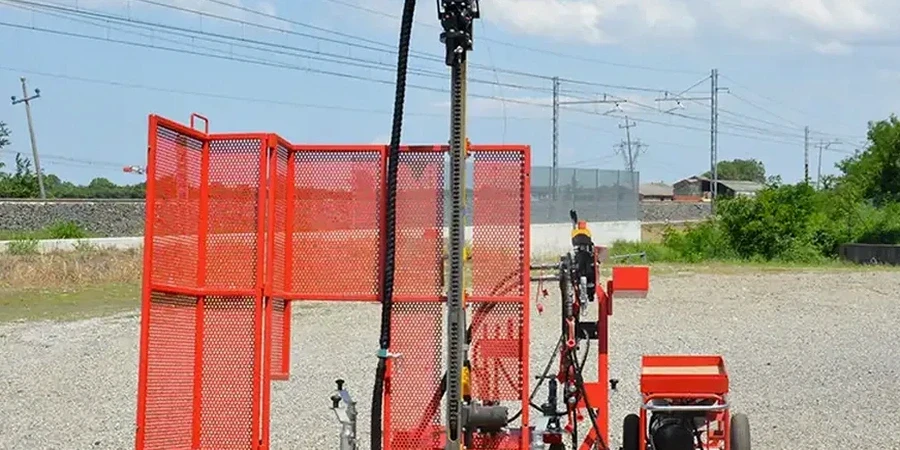
The CME-75 truck-mounted drill rig with its automatic 140 lb hammer dropping 30 inches onto the sampler barrel is a familiar sound on Mississauga construction sites. We set up the tripod and cathead system, lock in the A-size drill rods, and start the split-spoon sampler driving through the Halton Till. This dense mix of silty clay and stones is what defines most of the ground below Mississauga, and it demands a hammer that delivers exactly 60% energy efficiency to get N-values worth interpreting. Before the rig even arrives, we coordinate utility clearances with Alectra and Enbridge—a step that saves weeks of delays when you’re drilling within Mississauga’s tight lot lines. The data we pull from the spoon every 5 feet gives you more than just a refusal depth; it reveals the transition from the Oak Ridges Moraine sediments into the shale bedrock of the Georgian Bay Formation, and linking that geotechnical profile with a CPT test can fill in the gaps where the SPT alone leaves thin seams undetected.
A refusal at 45 blows with less than 6 inches of penetration in Mississauga’s shale doesn’t mean rock—it might just be a boulder in the till. That’s where experience matters.
Site-specific factors
Drilling in Port Credit’s sandy lakefill near the mouth of the Credit River feels nothing like drilling in Streetsville’s dense clay till up on the ridge. Near the lake, the spoon sinks under the hammer’s weight alone in saturated sand, and that’s where you risk misreading N-values if the hole isn’t cased properly to prevent heave. Up in Streetsville, you hit refusal on limestone floaters at 15 feet and the drill crew has to decide immediately whether that’s bedrock or just a glacial erratic—calling it wrong leads to a foundation design that’s either overbuilt and costly, or underbuilt and risky. The Credit River valley introduces another variable: a high groundwater table that can destabilize borehole walls between spoon intervals. Without a drilling mud program or temporary casing, the SPT data gets contaminated by slough, and the N-value you paid for is useless. The difference between a clean test and a compromised one in Mississauga’s mixed stratigraphy comes down to the driller’s ability to read the cuttings and adjust the method on the fly.
Regulatory framework
ASTM D1586-18: Standard Test Method for Standard Penetration Test (SPT) and Split-Barrel Sampling of Soils, ASTM D4633-16: Standard Test Method for Energy Measurement for Dynamic Penetrometers, CSA A23.3-19: Design of Concrete Structures (Anchorage and Foundation Provisions), NBCC 2015: National Building Code of Canada, Part 4 (Structural Design), MTO LS-702: Ontario Ministry of Transportation SPT Protocol
Frequently asked questions
What does an SPT test cost for a typical single-family home lot in Mississauga?
For a standard residential lot in Mississauga, you’re looking at CA$770 to CA$940 per borehole when we’re drilling to typical depths of 15 to 25 feet through Halton Till. That price covers the drill rig mobilization within the GTA, the full SPT logging with N-values every 5 feet, disturbed spoon samples for lab index testing, and the signed geotechnical borehole log. Sites requiring deeper drilling into the Georgian Bay shale or additional holes for a larger footprint will shift the cost upward, but we quote per-hole so you know exactly where the money goes before the rig shows up.
How do you handle SPT refusal in Mississauga’s shale bedrock?
We log refusal per ASTM D1586 when 50 blows advance the spoon less than 6 inches, or 100 blows total without reaching the sampling interval. In Mississauga, refusal often occurs at the contact with the Georgian Bay Formation shale—typically between 15 and 40 feet depth depending on where you are in the city. When that happens, we switch to NQ-size core barrel and start coring the rock to get RQD and recovery data, which gives the structural engineer the bearing capacity and rock quality numbers they need for end-bearing piles or drilled shafts. The refusal depth is recorded on the log with the exact blow count so nobody mistakes it for a boulder.
How many boreholes do I need for a commercial building in Mississauga?
The NBCC 2015 requires a minimum of one borehole per 200 square meters of building footprint, with at least three boreholes for any structure larger than 500 square meters—and that’s the floor, not the ceiling. For a typical commercial building in Mississauga’s industrial parks around Dixie Road or Meadowvale, we usually recommend four to six SPT boreholes spaced on a grid that captures the lateral variability of the Halton Till. If the site straddles a known buried valley or crosses into the Credit River floodplain, we add holes along the property line to define the transition zone, because the difference in N-values across 50 meters can be enough to change your foundation type entirely.