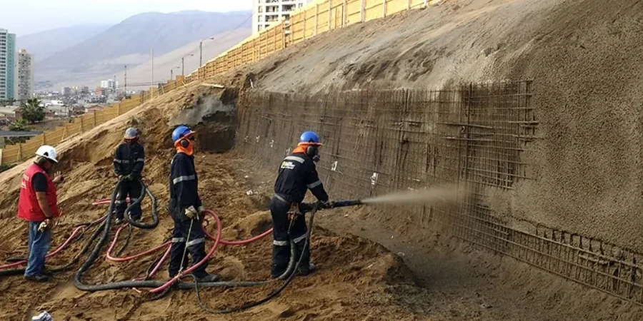
Mississauga's urban expansion from a quiet bedroom community into Canada's sixth-largest city has pushed development into increasingly complex terrain. The neighborhoods climbing the flanks of the Credit River valley and the subtle scarps of the South Slope present a geotechnical puzzle: the Halton Till over Queenston Shale offers reasonable bearing capacity, but its weathered upper layers—combined with seasonal saturation—create planes of weakness that demand rigorous evaluation. For any project near a grade change exceeding 3 meters or within 50 meters of a watercourse, the Ontario Building Code triggers a mandatory geotechnical assessment. Our approach to slope stability analysis integrates decades of regional drilling data with the specific requirements of the City of Mississauga's Development Engineering Group, ensuring your site plan withstands both the freeze-thaw cycles of a harsh Ontario winter and the intense rainfall events that have become more frequent across the GTA. We typically pair this assessment with a detailed in-situ permeability study when groundwater seepage is identified as a controlling factor in the slope model.
A factor of safety of 1.5 in Mississauga's till requires accounting for the complete loss of matric suction during the spring thaw—anything less is a gamble on the weather.
Site-specific factors
A contractor excavating for a custom home on Mississauga Road near the University of Toronto campus recently encountered a textbook rotational failure in the upper till. The excavation, cut to a 70-degree angle to maximize the building footprint, remained stable through August but began sloughing after 48 hours of sustained autumn rain. The project lost six weeks while a remedial design was engineered and approved. This is the hidden cost of skipping a proper stability analysis: the apparent saving vanishes the moment pore-water pressure exceeds the soil's matric suction. In Mississauga's silty clay tills, a slope that stands temporarily can fail catastrophically at a factor of safety below 1.1—well under the 1.5 required by the NBCC 2020 for permanent cuts. Our modeling maps the critical failure surface using limit equilibrium methods and finite element analysis, identifying not just if a slope will move, but how deep the failure plane extends and whether it threatens adjacent infrastructure or the streetscape above.
Frequently asked questions
What is the typical cost range for a slope stability analysis in Mississauga?
For most residential and small commercial sites in Mississauga, the analysis ranges from CA$1,600 to CA$5,160. The final figure depends on the slope height, the number of cross-sections required, and whether the site is within a regulated area requiring additional TRCA or CVC review. A site with existing borehole logs and laboratory data will fall at the lower end; a raw site requiring new drilling and triaxial testing will approach the upper end.
How long does the analysis take from start to finished report?
A typical timeline is three to four weeks. The first week covers field investigation if required. Laboratory testing—particularly consolidated drained triaxial tests—consumes the second week due to slow shearing rates. The third and fourth weeks are dedicated to modeling, sensitivity analysis of groundwater conditions, and report preparation. We can accommodate faster schedules for urgent projects when testing slots are available.
What triggers a mandatory slope stability study under Mississauga's bylaws?
The City of Mississauga's Site Plan Application process requires a geotechnical report including slope stability whenever development is proposed within the 'stable top of bank' setback—typically 15 meters from the crest of a valley or ravine, but this can increase based on slope height and soil type. The TRCA may also require an analysis under Ontario Regulation 166/06 if the property lies within a regulated floodplain or valley corridor.
Can you use existing soil data from a previous geotechnical report?
Sometimes. If the existing boreholes are within 30 meters of the proposed slope and the logs meet current professional standards, we can often incorporate that data to reduce investigation costs. However, we still require confirmation that the stratigraphy is consistent across the site and may recommend one additional borehole or test pit to verify the critical interface between the till and the underlying shale, which often controls the failure geometry in Mississauga.
What is the difference between drained and undrained analysis for a slope?
Drained analysis uses effective stress parameters (c' and φ') and models long-term conditions where water can flow through the soil. This governs permanent slopes in Mississauga's silty tills. Undrained analysis uses total stress parameters (Su) and applies to short-term conditions like a freshly cut excavation before pore pressures have equilibrated. We always check both conditions because a slope that is stable in the short term can fail years later if the drained factor of safety falls below 1.5.